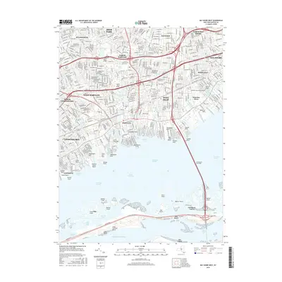
2016 Map of Bay Shore West
USGS Topo · Published 2016About this map
Babylon and the neighboring shoreline communities of West Islip and West Babylon anchor this South Shore landscape during a period of high suburban density. The map illustrates the complex interaction between land and water, from the residential grids of North Bay Shore to the intricate network of canals and inlets at Venetian Shores Beach. The interior is defined by significant green spaces and freshwater bodies, including Belmont Lake State Park and Guggenheims Lakes, while the southern portion transitions into the barrier islands across the Great South Bay.
Find a feature on this map
100 named features on this map. Tap any name to fly to it.
Don’t see what you’re looking for? This feature index may not catch every label — zoom into the map to look around manually.
Map Details
Editions of this 2016 Bay Shore West Map
This is the sole edition of this map. No revisions or reprints were ever made.
Other maps of this area

1901 · Babylon
USGS Topo · 1:62,500

1901 · Northport
USGS Topo · 1:62,500

1902 · Setauket
USGS Topo · 1:62,500

1902 · Fire Island
USGS Topo · 1:62,500

1903 · Babylon
USGS Topo · 1:62,500

1903 · Northport
USGS Topo · 1:62,500

1903 · Fire Island
USGS Topo · 1:62,500

1904 · Setauket
USGS Topo · 1:62,500

1904 · Islip
USGS Topo · 1:125,000

1919 · Setauket
USGS Topo · 1:62,500