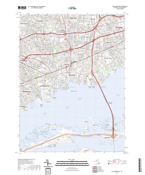
2023 Map of Bay Shore West
USGS Topo · Published 2023About this map
Wyandanch and Deer Park anchor the northern reaches of this coastal Suffolk County landscape, where the dense suburban grid of the early 21st century meets the complex shoreline of the Great South Bay. The map reveals a highly structured environment defined by major transit corridors, including the Southern State Pkwy and the Long Island Railroad. Moving south, the terrain transitions into a series of peninsulas or necks, such as Sequatogue Neck and Sampawams Neck, separated by tidal creeks like Carlls River and Santapogue Creek. Local history and genealogy are represented by sites like Breslau Cem and Babylon Cem. Beyond the mainland, the Great South Bay Bridge connects to the barrier beach system, featuring the sands of Jones Beach Island and the community at Oak Beach, illustrating the enduring relationship between these mainland settlements and the protected waters of the bay.
Find a feature on this map
80 named features on this map. Tap any name to fly to it.
Don’t see what you’re looking for? This feature index may not catch every label — zoom into the map to look around manually.
Map Details
Editions of this 2023 Bay Shore West Map
This is the sole edition of this map. No revisions or reprints were ever made.
Other maps of this area

1901 · Babylon
USGS Topo · 1:62,500

1901 · Northport
USGS Topo · 1:62,500

1902 · Setauket
USGS Topo · 1:62,500

1902 · Fire Island
USGS Topo · 1:62,500

1903 · Babylon
USGS Topo · 1:62,500

1903 · Northport
USGS Topo · 1:62,500

1903 · Fire Island
USGS Topo · 1:62,500

1904 · Setauket
USGS Topo · 1:62,500

1904 · Islip
USGS Topo · 1:125,000

1919 · Setauket
USGS Topo · 1:62,500