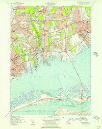
1954 Map of Bay Shore West
USGS Topo · Published 1956About this map
Wyandanch and Lindenhurst show the rapid suburbanization of Suffolk County following World War II. The landscape is defined by the expansion of the Southern State Parkway and its numbered interchanges, carving through established woods and around older estates like the Guggenheim Lakes. Large residential tracts have emerged around West Babylon and North Babylon, supported by a dense network of new educational facilities like the Santapogue Sch and Weeks Road Sch.
Find a feature on this map
97 named features on this map. Tap any name to fly to it.
Don’t see what you’re looking for? This feature index may not catch every label — zoom into the map to look around manually.
Map Details
Editions of this 1954 Bay Shore West Map
This is the sole edition of this map. No revisions or reprints were ever made.
Other maps of this area

1901 · Babylon
USGS Topo · 1:62,500

1901 · Northport
USGS Topo · 1:62,500

1902 · Setauket
USGS Topo · 1:62,500

1902 · Fire Island
USGS Topo · 1:62,500

1903 · Babylon
USGS Topo · 1:62,500

1903 · Northport
USGS Topo · 1:62,500

1903 · Fire Island
USGS Topo · 1:62,500

1904 · Setauket
USGS Topo · 1:62,500

1904 · Islip
USGS Topo · 1:125,000

1919 · Setauket
USGS Topo · 1:62,500