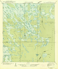
1949 Map of Bay Tambour
USGS Topo · Published 1949About this map
Coastal marshlands and intricate waterways define this deltaic landscape along the border of Jefferson and Lafourche parishes during the late 1940s. The region is a complex web of interconnected water bodies, including the expansive Bay Tambour and the sheltered Hatchet Lake. Human engineering is visible through the straight cut of the Southwestern Louisiana Canal near Bayou Garcia, which provided critical navigation through the tidal wetlands. Small islands and points like Andre Island and Martigan Pt serve as stable markers in a territory dominated by fluid boundaries.
Find a feature on this map
31 named features on this map. Tap any name to fly to it.
Don’t see what you’re looking for? This feature index may not catch every label — zoom into the map to look around manually.
Map Details
Editions of this 1949 Bay Tambour Map
2 editions found
Other maps of this area

1892 · Cheniere Caminada
USGS Topo · 1:62,500

1892 · Creole
USGS Topo · 1:62,500

1893 · Fort Livingston
USGS Topo · 1:62,500

1935 · Mink Bayou
USGS Topo · 1:31,680

1935 · Leeville
USGS Topo · 1:31,680

1935 · Wilkinson Bay
USGS Topo · 1:31,680

1945 · New Orleans
USGS Topo · 1:250,000

1945 · Leeville
USGS Topo · 1:31,680
1946 · Mink Bayou
USGS Topo · 1:31,680

1947 · Caminada Pass
USGS Topo · 1:31,680