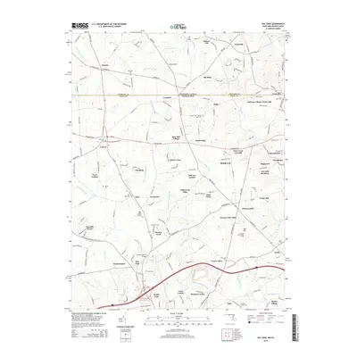
2014 Map of Bay View
USGS Topo · Published 2014About this map
North East Creek and Little Northeast Creek flow southward across the state line, carving a landscape defined by small crossroad settlements and long-standing rural institutions. This 2014 survey captures the borderlands between Pennsylvania and Maryland, where historical sites like Gilpins Covered Bridge and Moores Chapel Cem stand alongside modern developments such as Cecil Coll. The map reveals a transition from traditional agricultural areas like Blue Ball Village and Chrome to newer residential clusters including Wyn Lea at Fair Hill and Chantilly Manor. Notable landmarks such as the Pleasant Hill Lookout Tower and Gilpins Falls punctuate the drainage basins, while small aviation sites like Cohen Airport and High Valley Airport highlight the local transportation network. The proximity of numerous cemeteries, including Saint Johns Cem and Boulden Chapel Cem, provides significant points of interest for those documenting the region's family lineages.
Find a feature on this map
189 named features on this map. Tap any name to fly to it.
Don’t see what you’re looking for? This feature index may not catch every label — zoom into the map to look around manually.
Map Details
Editions of this 2014 Bay View Map
This is the sole edition of this map. No revisions or reprints were ever made.
Other maps of this area

1898 · Elkton
USGS Topo · 1:62,500

1900 · Elkton
USGS Topo · 1:62,500

1900 · Havre De Grace
USGS Topo · 1:62,500

1904 · Coatesville
USGS Topo · 1:62,500

1906 · Coatesville
USGS Topo · 1:62,500

1912 · Quarryville
USGS Topo · 1:62,500

1917 · Elkton
USGS Topo · 1:62,500

1918 · Coatesville
USGS Topo · 1:62,500

1942 · Havre De Grace
USGS Topo · 1:62,500

1942 · Elkton
USGS Topo · 1:62,500