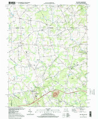
1997 Map of Bay View
USGS Topo · Published 1999About this map
The rolling Maryland-Pennsylvania borderlands are meticulously documented in this late 20th-century survey, centered on the unincorporated community of Bay View. This transition zone between the Piedmont and the coastal plain is marked by a dense network of country roads like Trinity Church Road and England Cemetery Road, connecting long-standing institutions such as Cecil Community College and Rising Sun High Sch. The map reveals a deeply rooted landscape where community life centers on spiritual and educational landmarks, from the Media Chapel in the north to Leeds Sch in the southeast.
Find a feature on this map
86 named features on this map. Tap any name to fly to it.
Don’t see what you’re looking for? This feature index may not catch every label — zoom into the map to look around manually.
Map Details
Editions of this 1997 Bay View Map
This is the sole edition of this map. No revisions or reprints were ever made.
Other maps of this area

1898 · Elkton
USGS Topo · 1:62,500

1900 · Elkton
USGS Topo · 1:62,500

1900 · Havre De Grace
USGS Topo · 1:62,500

1904 · Coatesville
USGS Topo · 1:62,500

1906 · Coatesville
USGS Topo · 1:62,500

1912 · Quarryville
USGS Topo · 1:62,500

1917 · Elkton
USGS Topo · 1:62,500

1918 · Coatesville
USGS Topo · 1:62,500

1942 · Havre De Grace
USGS Topo · 1:62,500

1942 · Elkton
USGS Topo · 1:62,500