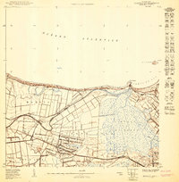
1950 Map of Bayamon NO
USGS Topo · Published 1950About this map
Coastal sugar cultivation and early telecommunications infrastructure define this 1950 coastal landscape near Dorado. The American Railroad of Porto Rico cuts across the southern terrain, connecting the sugar settlement at Ingenio with the surrounding agricultural barrios of Media Luna and Mameyal. This era marks a transition from purely agrarian use to specialized federal and broadcast utility, evidenced by the large Reservación Naval and several prominent transmitter sites such as the Estación de Radio WIPR and Antenas de Radio WIBS.
Find a feature on this map
23 named features on this map. Tap any name to fly to it.
Don’t see what you’re looking for? This feature index may not catch every label — zoom into the map to look around manually.
Map Details
Editions of this 1950 Bayamon NO Map
This is the sole edition of this map. No revisions or reprints were ever made.
Other maps of this area

1940 · Vega Alta
USGS Topo · 1:30,000

1941 · Bayamon
USGS Topo · 1:30,000

1946 · Vega Alta
USGS Topo · 1:30,000

1947 · Bayamon
USGS Topo · 1:30,000
1950 · Bayamon NE
USGS Topo · 1:10,000
1950 · Bayamon SO
USGS Topo · 1:10,000
1950 · Vega Alta NE
USGS Topo · 1:10,000
1950 · Vega Alta SE
USGS Topo · 1:10,000
1950 · Bayamon SE
USGS Topo · 1:10,000
1953 · Vega Alta
USGS Topo · 1:30,000