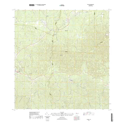
2018 Map of Bayaney
USGS Topo · Published 2018About this map
Bayaney and the eastern edge of Lares occupy a landscape defined by the intricate karst topography of the Island of Puerto Rico. This 2018 survey documents a region where human settlement is deeply intertwined with a complex hydrological network, featuring the winding courses of Rio Camuy, Rio Tanamá, and Rio Angeles. One of the most striking natural features is the Tres Pueblos Sinkhole, a massive collapse structure that exemplifies the limestone geology of the northern highlands. The map provides significant detail for local historians, identifying numerous named roads such as Carr Echegaray and Ave Los Patriotas, alongside several rural burial grounds including Cementerio de Quebrada and Cementerio de Albonito. These landmarks, along with high points like Cerro Palma, illustrate the rugged character of the municipalities of Camuy, Lares, Hatillo, Arecibo, and Utuado.
Find a feature on this map
49 named features on this map. Tap any name to fly to it.
Don’t see what you’re looking for? This feature index may not catch every label — zoom into the map to look around manually.
Map Details
Editions of this 2018 Bayaney Map
This is the sole edition of this map. No revisions or reprints were ever made.
Other maps of this area

1938 · Camuy
USGS Topo · 1:20,000

1938 · San Sebastian
USGS Topo · 1:20,000

1938 · Quebradillas
USGS Topo · 1:20,000

1941 · San Sebastian
USGS Topo · 1:30,000

1942 · Arecibo
USGS Topo · 1:30,000

1942 · Camuy
USGS Topo · 1:30,000

1946 · Maricao
USGS Topo · 1:30,000

1946 · Utuado
USGS Topo · 1:30,000

1946 · Bayaney
USGS Topo · 1:30,000

1946 · Monte Guilarte
USGS Topo · 1:30,000
Featured Places
- Alturas de Quebrada, Camuy
- Parcelas Miria, Lares
- Sector Juan Pagán, Hatillo
- Sector Los Santiagos, Lares
- Sector Las Cuarenta, Hatillo