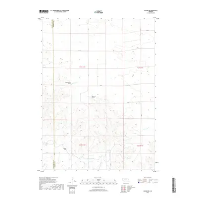
2017 Map of Bayard NE
USGS Topo · Published 2017About this map
The High Plains of western Nebraska are defined by a complex network of seasonal drainages and irrigation infrastructure along the border of Scotts Bluff and Morrill counties. The landscape transitions from the higher elevations of the north down toward the North Platte valley, carved by the winding course of Ninemile Creek and the steep breaks of Wildhorse Canyon. Human efforts to manage the arid environment are visible in the engineering of the Highline Canal and the High Line Canal, which trace the contours of the southern hills. These waterways demonstrate the vital importance of irrigation to the agricultural viability of the region. Local geography is further articulated by named landmarks such as East Ninemile Canyon and W Water Creek, which provide key reference points for land management and historical property research in this part of the Nebraska Panhandle.
Find a feature on this map
22 named features on this map. Tap any name to fly to it.
Don’t see what you’re looking for? This feature index may not catch every label — zoom into the map to look around manually.
Map Details
Editions of this 2017 Bayard NE Map
This is the sole edition of this map. No revisions or reprints were ever made.
Other maps of this area

1898 · Camp Clarke
USGS Topo · 1:125,000

1948 · Hemingford 4 SW
USGS Topo · 1:24,000

1951 · Kilpatrick Lake
USGS Topo · 1:62,500

1954 · Scottsbluff
USGS Topo · 1:250,000

1955 · Alliance
USGS Topo · 1:250,000

1957 · Alliance
USGS Topo · 1:250,000

1958 · Alliance
USGS Topo · 1:250,000

1958 · Scottsbluff
USGS Topo · 1:250,000

1965 · Bayard
USGS Topo · 1:24,000
1965 · Bayard NE
USGS Topo · 1:24,000