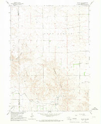
1965 Map of Bayard NE
USGS Topo · Published 1967About this map
Agricultural development in western Nebraska dominates this mid-1960s survey, particularly where the Highland High Line Canal and Highland Lowline Canal snake through the southern portion of the quadrangle. These irrigation systems, complete with several siphons, transformed the high plains landscape into productive cropland, marked here by extensive fence and field lines. The terrain is characterized by the descent from the elevated Field and Goodstreak districts toward the North Platte River valley, carved by deep drainage features like Ninemile Canyon and the prominent Wildhorse Canyon.
Find a feature on this map
15 named features on this map. Tap any name to fly to it.
Don’t see what you’re looking for? This feature index may not catch every label — zoom into the map to look around manually.
Map Details
Editions of this 1965 Bayard NE Map
This is the sole edition of this map. No revisions or reprints were ever made.
Other maps of this area

1898 · Camp Clarke
USGS Topo · 1:125,000

1948 · Hemingford 4 SW
USGS Topo · 1:24,000

1951 · Kilpatrick Lake
USGS Topo · 1:62,500

1954 · Scottsbluff
USGS Topo · 1:250,000

1955 · Alliance
USGS Topo · 1:250,000

1957 · Alliance
USGS Topo · 1:250,000

1958 · Alliance
USGS Topo · 1:250,000

1958 · Scottsbluff
USGS Topo · 1:250,000

1965 · Bayard
USGS Topo · 1:24,000
1965 · Angora NW
USGS Topo · 1:24,000