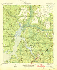
1945 Map of Bayhead
USGS Topo · Published 1945About this map
The St Andrews Bay shoreline and its intricate network of inlets define the landscape of this 1940s Bay County survey. Small waterside communities like Resota Beach and High Point are shown at a time when the region's geography was dictated by the confluence of Econfina Creek and Bear Creek. The map documents the intricate transition from deep bay waters to tidal marshes, featuring numerous named points and bayous such as Deer Point, College Point, and Gainer Bayou.
Find a feature on this map
27 named features on this map. Tap any name to fly to it.
Don’t see what you’re looking for? This feature index may not catch every label — zoom into the map to look around manually.
Map Details
Editions of this 1945 Bayhead Map
3 editions found
Other maps of this area

1943 · Panama City
USGS Topo · 1:31,680

1943 · Southport
USGS Topo · 1:24,000

1944 · Southport
USGS Topo · 1:24,000

1944 · Crystal Lake
USGS Topo · 1:24,000

1944 · Bayhead
USGS Topo · 1:24,000

1944 · Bennett
USGS Topo · 1:24,000

1945 · Youngstown
USGS Topo · 1:31,680

1945 · Bennett
USGS Topo · 1:31,680

1945 · Bayhead
USGS Topo · 1:31,680

1945 · North Of Allanton
USGS Topo · 1:31,680