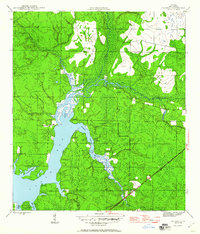
1945 Map of Bayhead
USGS Topo · Published 1960About this map
North Bay dominates this mid-1940s landscape, serving as the central drainage for a network of winding waterways including the Econfina River and Bayou George. This coastal region of Bay County is characterized by numerous protected inlets such as Gainer Bayou, Hodges Bayou, and Beatty Bayou, which reflect the area's intricate shoreline and maritime character. Small communities like Bayhead and Camp Flowers are established inland, while Resota Beach sits along the bay front.
Find a feature on this map
23 named features on this map. Tap any name to fly to it.
Don’t see what you’re looking for? This feature index may not catch every label — zoom into the map to look around manually.
Map Details
Editions of this 1945 Bayhead Map
3 editions found
Other maps of this area

1943 · Panama City
USGS Topo · 1:31,680

1943 · Southport
USGS Topo · 1:24,000

1944 · Southport
USGS Topo · 1:24,000

1944 · Crystal Lake
USGS Topo · 1:24,000

1944 · Bayhead
USGS Topo · 1:24,000

1944 · Bennett
USGS Topo · 1:24,000

1945 · Youngstown
USGS Topo · 1:31,680

1945 · Bennett
USGS Topo · 1:31,680

1945 · Bayhead
USGS Topo · 1:31,680

1945 · North Of Allanton
USGS Topo · 1:31,680