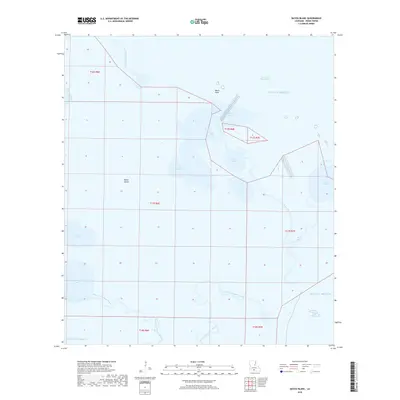
2018 Map of Bayou Blanc
USGS Topo · Published 2018About this map
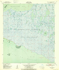
Marsh Island dominates this coastal landscape in Iberia Parish, revealing the intricate water systems of the Louisiana shoreline in the early 21st century. The map detail highlights a labyrinth of inland lakes and interconnected waterways, where bodies like Lake Blanc, Lake Michael, and Scat Lake are carved out of the wetlands. These interior waters feed into prominent drainage channels including Bayou Blanc and Joe Aucoin Bayou, which manage the tidal flow between the marsh and the surrounding bays. Near Worm Point, the transition from land to the Gulf of Mexico is marked by tidal features such as Worm Cove and Worm Bayou. To the south, the branching network of West Branch Oyster Bayou and East Branch Oyster Bayou illustrates the natural hydrology of the coastal zone, situated between West Cote Blanche Bay and East Cote Blanche Bay.
Find a feature on this map
23 named features on this map. Tap any name to fly to it.
Don’t see what you’re looking for? This feature index may not catch every label — zoom into the map to look around manually.
Map Details
Editions of this 2018 Bayou Blanc Map
This is the sole edition of this map. No revisions or reprints were ever made.
Other maps of this area

1932 · Bayou Blanc
USGS Topo · 1:31,680

1937 · Bayou Sale
USGS Topo · 1:62,500

1945 · New Orleans
USGS Topo · 1:250,000
1948 · Bayou Blanc
USGS Topo · 1:24,000

1948 · Cypremort Point
USGS Topo · 1:24,000

1949 · Cypremort Pt
USGS Topo · 1:31,680

1949 · Bayou Lucien
USGS Topo · 1:31,680
1951 · Lake Point
USGS Topo · 1:24,000
1951 · Mound Point
USGS Topo · 1:24,000
1951 · Bayou Lucien
USGS Topo · 1:24,000