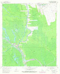
1969 Map of Bayou Sorrel
USGS Topo · Published 1980About this map
The Atchafalaya Basin Floodway dominates this Iberville Parish landscape, where the intricate transition between natural bayous and industrial infrastructure is clearly documented. The settlement of Bayou Sorrel serves as a focal point near the Bayou Sorrel Locks, marking a critical junction for navigation. The presence of the Intracoastal Waterway (Alternate Route) and the Lower Grand River illustrates the region's reliance on waterborne transport for both commerce and energy extraction. Extensive energy development is visible through the Crescent Oil Field, Sullivan Lake Oil and Gas Field, and Bayou Sorrel Oil and Gas Field, which are crisscrossed by a complex network of pipelines. Cultural landmarks like the Indian Mound Cem and Bayou Plaquemine Ch near The Parks provide essential grounding for genealogists tracking local families in this swampy, resource-rich environment.
Find a feature on this map
39 named features on this map. Tap any name to fly to it.
Don’t see what you’re looking for? This feature index may not catch every label — zoom into the map to look around manually.
Map Details
Editions of this 1969 Bayou Sorrel Map
3 editions found
Other maps of this area

1908 · Baton Rouge
USGS Topo · 1:62,500

1935 · Chicot Lake
USGS Topo · 1:62,500

1936 · White Castle
USGS Topo · 1:62,500

1939 · Baton Rouge
USGS Topo · 1:62,500

1940 · Grosse Tete
USGS Topo · 1:62,500

1953 · Crescent
USGS Topo · 1:24,000

1953 · Plaquemine
USGS Topo · 1:24,000

1953 · Pigeon Bay
USGS Topo · 1:24,000

1953 · Addis
USGS Topo · 1:24,000

1953 · Grosse Tete SW
USGS Topo · 1:24,000