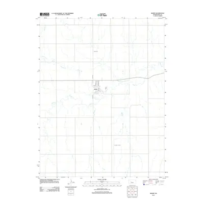
2012 Map of Bazine
USGS Topo · Published 2012About this map
Bazine is situated as a central hub for the surrounding agricultural and industrial landscape of Ness County. The town site is defined by a grid of local streets including N Austin St and N Lawrence St, centered around the local Po. To the north, the Bazine Cem serves as a significant genealogical landmark, while the southern portion of the quadrangle is marked by the presence of the Margheim Oil Field, indicating the area's continued reliance on natural resource extraction. The hydrology of the region is characterized by the meandering paths of Walnut Cr and its tributary, Bazine Dry Cr. These waterways cut through the sections, shaping the layout of country roads and land use patterns in this part of western Kansas.
Find a feature on this map
11 named features on this map. Tap any name to fly to it.
Don’t see what you’re looking for? This feature index may not catch every label — zoom into the map to look around manually.
Map Details
Editions of this 2012 Bazine Map
This is the sole edition of this map. No revisions or reprints were ever made.
Other maps of this area

1892 · Ness
USGS Topo · 1:125,000

1893 · Ellis
USGS Topo · 1:125,000

1894 · Ness
USGS Topo · 1:125,000

1955 · Great Bend
USGS Topo · 1:250,000

1957 · Great Bend
USGS Topo · 1:250,000

1958 · Great Bend
USGS Topo · 1:250,000

1965 · Mc Cracken
USGS Topo · 1:24,000

1966 · Alexander
USGS Topo · 1:24,000

1966 · Ransom SE
USGS Topo · 1:24,000

1966 · Mc Cracken SW
USGS Topo · 1:24,000