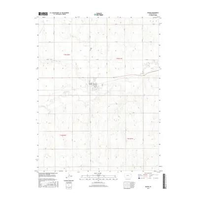
2015 Map of Bazine
USGS Topo · Published 2015About this map
Bazine serves as the central hub of this Ness County landscape, situated where the high plains meet the winding path of Walnut Cr. The town's grid is clearly defined by residential thoroughfares such as N Main St, S Lawrence St, and N Waunbaugh St, illustrating the concentrated development of this agricultural community. North of the primary settlement, the Bazine Cem stands as a significant point of local lineage and history, positioned near the intersection of N DD RD and E 150 RD. The surrounding terrain is shaped by the seasonal hydrology of Bazine Dry Cr, while a strict section-line road network, including routes like N GG RD and E 160 RD, reflects the enduring legacy of the Public Land Survey System in western Kansas.
Find a feature on this map
29 named features on this map. Tap any name to fly to it.
Don’t see what you’re looking for? This feature index may not catch every label — zoom into the map to look around manually.
Map Details
Editions of this 2015 Bazine Map
This is the sole edition of this map. No revisions or reprints were ever made.
Other maps of this area

1892 · Ness
USGS Topo · 1:125,000

1893 · Ellis
USGS Topo · 1:125,000

1894 · Ness
USGS Topo · 1:125,000

1955 · Great Bend
USGS Topo · 1:250,000

1957 · Great Bend
USGS Topo · 1:250,000

1958 · Great Bend
USGS Topo · 1:250,000

1965 · Mc Cracken
USGS Topo · 1:24,000

1966 · Alexander
USGS Topo · 1:24,000

1966 · Ransom SE
USGS Topo · 1:24,000

1966 · Mc Cracken SW
USGS Topo · 1:24,000