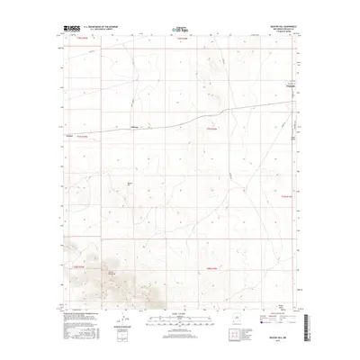
2017 Map of Beacon Hill
USGS Topo · Published 2017About this map
Animas Mountains dominate the southwestern corner of this survey, rising sharply from the basin floor and providing a topographic contrast to the surrounding valley. The landscape is defined by the high desert plains of the Playas Valley and the smaller settlement hubs of Animas and Antelope. A distinct network of rural infrastructure is visible, including the aptly named Windmill and a web of ranching and utility corridors such as Windmill Rd and Powerline Rd.
Find a feature on this map
22 named features on this map. Tap any name to fly to it.
Don’t see what you’re looking for? This feature index may not catch every label — zoom into the map to look around manually.
Map Details
Editions of this 2017 Beacon Hill Map
This is the sole edition of this map. No revisions or reprints were ever made.
Other maps of this area

1918 · Playas
USGS Topo · 1:62,500

1918 · Pratt
USGS Topo · 1:62,500

1919 · Pratt
USGS Topo · 1:62,500

1919 · Playas
USGS Topo · 1:62,500

1954 · Silver City
USGS Topo · 1:250,000

1955 · Douglas
USGS Topo · 1:250,000

1958 · Silver City
USGS Topo · 1:250,000

1959 · Douglas
USGS Topo · 1:250,000

1961 · Douglas
USGS Topo · 1:250,000

1962 · Silver City
USGS Topo · 1:250,000