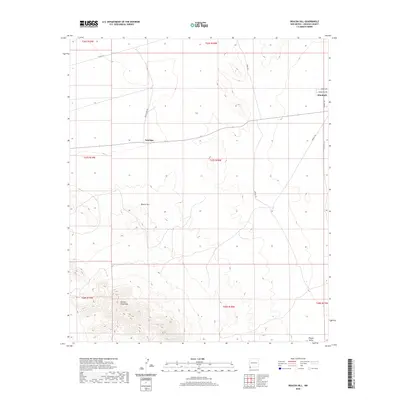
2020 Map of Beacon Hill
USGS Topo · Published 2020About this map
Antelope and Windmill anchor this sparsely populated stretch of Hidalgo County, where the desert landscape transitions into the northern reaches of the Animas Mountains. The mapping detail captures a network of rural routes such as Sock N Shoe Rd and Mineral Rd that cross the arid basins between high points like Beacon Hill. This area is characterized by large township and range blocks that define the ranching and resource-extraction heritage of the New Mexico borderlands. To the southeast, the land descends toward the Playas Valley, a region defined by its wide, flat expanses and the infrastructure necessary to maintain life in the high desert, including the prominent Powerline Rd running along the eastern margin. The survey provides a clear look at the topography and access points used by local families and land managers in the 21st century.
Find a feature on this map
20 named features on this map. Tap any name to fly to it.
Don’t see what you’re looking for? This feature index may not catch every label — zoom into the map to look around manually.
Map Details
Editions of this 2020 Beacon Hill Map
This is the sole edition of this map. No revisions or reprints were ever made.
Other maps of this area

1918 · Playas
USGS Topo · 1:62,500

1918 · Pratt
USGS Topo · 1:62,500

1919 · Pratt
USGS Topo · 1:62,500

1919 · Playas
USGS Topo · 1:62,500

1954 · Silver City
USGS Topo · 1:250,000

1955 · Douglas
USGS Topo · 1:250,000

1958 · Silver City
USGS Topo · 1:250,000

1959 · Douglas
USGS Topo · 1:250,000

1961 · Douglas
USGS Topo · 1:250,000

1962 · Silver City
USGS Topo · 1:250,000