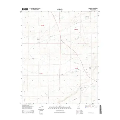
2014 Map of Beacon Well
USGS Topo · Published 2014About this map
Us-191 cuts diagonally across this high-desert landscape in Northeastern Arizona, providing the primary artery through a region defined by seasonal water and scattered ranch roads. Small, isolated catchments like Beacon Well and Michigan Lake provide critical reference points for navigation, while the expansive Morgan Canyon and Parker Draw drainages shape the local topography. This 2014 survey captures a network of rural routes and Bureau of Indian Affairs roads, including Bia-2004 and Bia-2005, which branch off the main highway to serve remote reaches. Further south, the terrain descends toward Francisco Lake, near where residential names such as Eagle Ridge Ln and Sunset Ln suggest modern land use patterns emerging alongside established grazing lands and the winding Hardscrabble Rd.
Find a feature on this map
32 named features on this map. Tap any name to fly to it.
Don’t see what you’re looking for? This feature index may not catch every label — zoom into the map to look around manually.
Map Details
Editions of this 2014 Beacon Well Map
This is the sole edition of this map. No revisions or reprints were ever made.
Other maps of this area

1886 · St Johns
USGS Topo · 1:250,000

1886 · Fort Defiance
USGS Topo · 1:250,000

1892 · Fort Defiance
USGS Topo · 1:250,000

1892 · St Johns
USGS Topo · 1:250,000

1954 · Saint Johns
USGS Topo · 1:250,000

1954 · Gallup
USGS Topo · 1:250,000

1957 · Saint Johns
USGS Topo · 1:250,000

1958 · Gallup
USGS Topo · 1:250,000

1958 · Saint Johns
USGS Topo · 1:250,000

1959 · Gallup
USGS Topo · 1:250,000