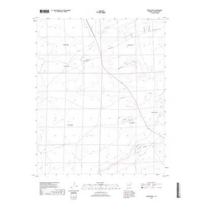
2018 Map of Beacon Well
USGS Topo · Published 2018About this map
Beacon Well stands as a focal point in this high-plateau landscape of Apache County, where the topography is defined by the significant drainage of Parker Draw and the descent into Morgan Canyon. The 2018 survey reveals a sparse but deliberate network of ranch and residential roads, including Middle Well Rd and BIA Rte 2030, serving the remote corners of the Fort Defiance Agency. Water management remains critical to life in this arid environment, evidenced by livestock-sustaining features like East Tank and seasonally fluctuating basins such as Michigan Lake, Long Tree Lake, and Francisco Lake. This map captures the modern rural infrastructure of the Navajo Nation, documenting how family-named routes like Howell Mesa Dr and small neighborhood clusters along Sunset Ln and Eagle Ridge Ln have integrated into the township and range system.
Find a feature on this map
27 named features on this map. Tap any name to fly to it.
Don’t see what you’re looking for? This feature index may not catch every label — zoom into the map to look around manually.
Map Details
Editions of this 2018 Beacon Well Map
This is the sole edition of this map. No revisions or reprints were ever made.
Other maps of this area

1886 · St Johns
USGS Topo · 1:250,000

1886 · Fort Defiance
USGS Topo · 1:250,000

1892 · Fort Defiance
USGS Topo · 1:250,000

1892 · St Johns
USGS Topo · 1:250,000

1954 · Saint Johns
USGS Topo · 1:250,000

1954 · Gallup
USGS Topo · 1:250,000

1957 · Saint Johns
USGS Topo · 1:250,000

1958 · Gallup
USGS Topo · 1:250,000

1958 · Saint Johns
USGS Topo · 1:250,000

1959 · Gallup
USGS Topo · 1:250,000