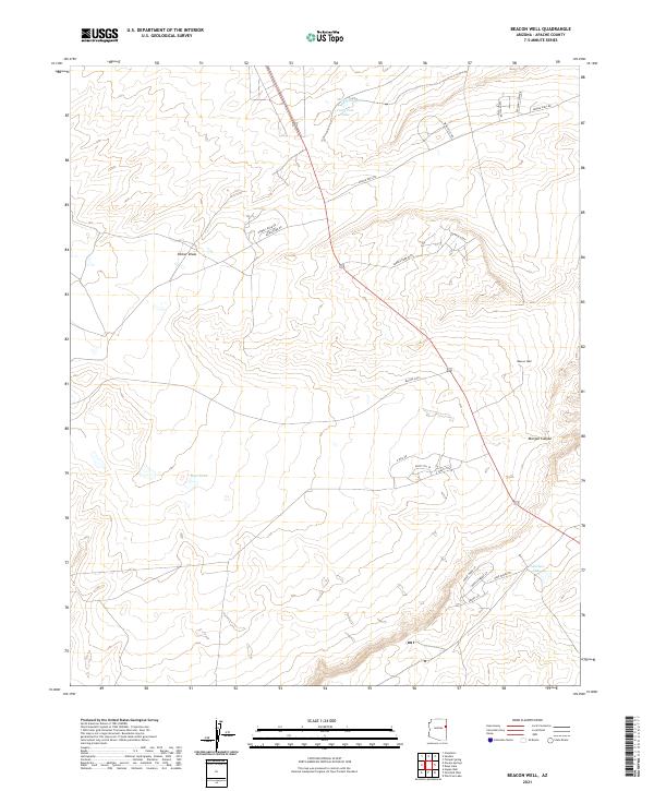
2021 Map of Beacon Well
USGS Topo · Published 2021About this map
Beacon Well stands as a focal landmark in this high-desert portion of Apache County, where the landscape is defined by drainage patterns and sparse water resources. The terrain is marked by the winding courses of Parker Draw and Morgan Canyon, which provide geographical structure to the open country. Isolated water features like Michigan Lake, Long Tree Lake, and Francisco Lake are critical points on the landscape, suggesting the historical and ongoing importance of water management in this arid region.
Find a feature on this map
26 named features on this map. Tap any name to fly to it.
Don’t see what you’re looking for? This feature index may not catch every label — zoom into the map to look around manually.
Map Details
Editions of this 2021 Beacon Well Map
This is the sole edition of this map. No revisions or reprints were ever made.
Other maps of this area

1886 · St Johns
USGS Topo · 1:250,000

1886 · Fort Defiance
USGS Topo · 1:250,000

1892 · Fort Defiance
USGS Topo · 1:250,000

1892 · St Johns
USGS Topo · 1:250,000

1954 · Saint Johns
USGS Topo · 1:250,000

1954 · Gallup
USGS Topo · 1:250,000

1957 · Saint Johns
USGS Topo · 1:250,000

1958 · Gallup
USGS Topo · 1:250,000

1958 · Saint Johns
USGS Topo · 1:250,000

1959 · Gallup
USGS Topo · 1:250,000