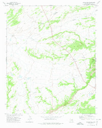
1972 Map of Beacon Well
USGS Topo · Published 1974About this map
Beacon Well serves as a central landmark in this high-desert region of Apache County, where the landscape is defined by the vital search for water. Published in the early 1970s, the survey captures an environment of remote ranching and early resource exploration. Vital water sources are scattered across the terrain, from Michigan Lake and Long Tree Lake in the north to Francisco Lake and a secluded Spring in the south. The infrastructure of the era is evidenced by features like the Water Tank Windmill and East Tank, alongside evidence of geological prospecting at the Good Luck Well, various Gas Wells, and a Dry Well. The natural topography is carved by Parker Draw and the more significant Morgan Canyon to the east, revealing a territory where the placement of every well and borrow pit was critical to sustaining life and industry in the arid Arizona interior.
Find a feature on this map
14 named features on this map. Tap any name to fly to it.
Don’t see what you’re looking for? This feature index may not catch every label — zoom into the map to look around manually.
Map Details
Editions of this 1972 Beacon Well Map
This is the sole edition of this map. No revisions or reprints were ever made.
Other maps of this area

1886 · St Johns
USGS Topo · 1:250,000

1886 · Fort Defiance
USGS Topo · 1:250,000

1892 · Fort Defiance
USGS Topo · 1:250,000

1892 · St Johns
USGS Topo · 1:250,000

1954 · Saint Johns
USGS Topo · 1:250,000

1954 · Gallup
USGS Topo · 1:250,000

1957 · Saint Johns
USGS Topo · 1:250,000

1958 · Gallup
USGS Topo · 1:250,000

1958 · Saint Johns
USGS Topo · 1:250,000

1959 · Gallup
USGS Topo · 1:250,000