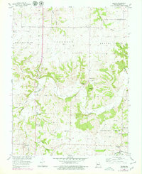
1953 Map of Beaman
USGS Topo · Published 1979About this map
Muddy Creek and its many tributaries, including Smelser Creek and Turkey Creek, carve a winding path through this central Missouri landscape. The 1953 topography, updated with revisions in the late 1970s, reveals a rural community anchored by small crossroads and a network of country schools and churches. The Missouri Kansas Texas railroad line cuts through the southeastern corner near Beaman, while the historic settlement of Georgetown sits to the west. Scattered throughout the landscape are numerous family and community landmarks, such as High Hill Cem and Olive Branch Ch, which serve as vital points of reference for genealogists tracing ancestral homesteads. The presence of a Quarry and regional pipelines hints at the local industrial and utility infrastructure that supported these townships during the mid-20th century.
Find a feature on this map
31 named features on this map. Tap any name to fly to it.
Don’t see what you’re looking for? This feature index may not catch every label — zoom into the map to look around manually.
Map Details
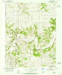
Editions of this 1953 Beaman Map
2 editions found
Other maps of this area

1887 · Sedalia
USGS Topo · 1:125,000

1894 · Sedalia
USGS Topo · 1:125,000

1939 · Sweet Springs
USGS Topo · 1:62,500

1940 · Sweet Springs
USGS Topo · 1:62,500

1941 · Sweet Springs
USGS Topo · 1:62,500

1944 · Sedalia West
USGS Topo · 1:24,000

1944 · Sedalia East
USGS Topo · 1:24,000

1945 · Sweet Springs
USGS Topo · 1:62,500

1946 · Sedalia West
USGS Topo · 1:24,000

1946 · Sedalia East
USGS Topo · 1:24,000