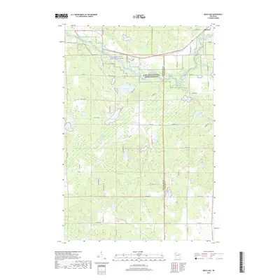
2019 Map of Bean Lake
USGS Topo · Published 2019About this map
The Namekagon River winds through the northern reaches of this landscape, protected as part of the Saint Croix National Scenic Riverway. Near the outskirts of Hayward, the terrain is defined by a glacial topography of scattered lakes and wetland basins. Large water bodies such as Bean Lake, Loon Lake, and Beaver Lake are joined by smaller, remote features like Devils Lake and Mud Lake. The drainage network is anchored by Bean Brook and its tributary Little Bean Brook, which flow through the forested areas west of the Washburn and Sawyer county line. A grid of local roads and fire lanes, including Deer Lane Rd and Fire Lane Rd, provides access to these timberlands and lakeside properties, reflecting the area's transition from wild river corridor to rural recreation and residence.
Find a feature on this map
62 named features on this map. Tap any name to fly to it.
Don’t see what you’re looking for? This feature index may not catch every label — zoom into the map to look around manually.
Map Details
Editions of this 2019 Bean Lake Map
This is the sole edition of this map. No revisions or reprints were ever made.
Other maps of this area

1944 · Couderay
USGS Topo · 1:48,000

1944 · Hayward
USGS Topo · 1:48,000

1947 · Chittamo
USGS Topo · 1:48,000

1948 · Couderay
USGS Topo · 1:48,000

1948 · Stone Lake
USGS Topo · 1:48,000

1949 · Chittamo
USGS Topo · 1:48,000

1950 · Stone Lake
USGS Topo · 1:48,000

1953 · Ashland
USGS Topo · 1:250,000

1953 · Rice Lake
USGS Topo · 1:250,000

1958 · Ashland
USGS Topo · 1:250,000