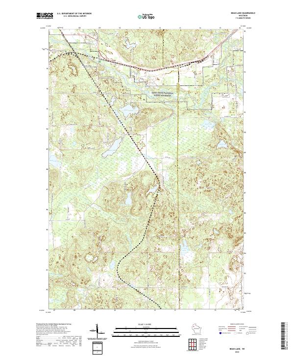
2022 Map of Bean Lake
USGS Topo · Published 2022About this map
Glacial water bodies and protected wetlands define the terrain of the Saint Croix National Wild and Scenic Riverway at the northern edge of the Washburn and Sawyer county line. This landscape is a complex network of kettle lakes and slow-moving watercourses, including Bean Lake, Beaver Lake, and the expansive marshlands surrounding Mud Lake. The drainage pattern is driven by the meandering Bean Brook and its southern tributary, Little Bean Brook, which carve through the dense woodlands. The presence of numerous named lakes such as Loon Lake, Tripp Lake, and the secluded Devils Lake suggests a region primarily shaped by conservation and seasonal recreation rather than intensive industrial development. The road network, consisting of routes like Fire Lane Rd and Co Rd S, remains sparse, reflecting the protected status of the river corridor and the preservation of the surrounding wilderness.
Find a feature on this map
76 named features on this map. Tap any name to fly to it.
Don’t see what you’re looking for? This feature index may not catch every label — zoom into the map to look around manually.
Map Details
Editions of this 2022 Bean Lake Map
This is the sole edition of this map. No revisions or reprints were ever made.
Other maps of this area

1944 · Couderay
USGS Topo · 1:48,000

1944 · Hayward
USGS Topo · 1:48,000

1947 · Chittamo
USGS Topo · 1:48,000

1948 · Couderay
USGS Topo · 1:48,000

1948 · Stone Lake
USGS Topo · 1:48,000

1949 · Chittamo
USGS Topo · 1:48,000

1950 · Stone Lake
USGS Topo · 1:48,000

1953 · Ashland
USGS Topo · 1:250,000

1953 · Rice Lake
USGS Topo · 1:250,000

1958 · Ashland
USGS Topo · 1:250,000