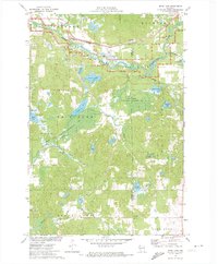
1971 Map of Bean Lake
USGS Topo · Published 1974About this map
The Namekagon River and the St Croix National Scenic Riverway anchor this pocket of the Wisconsin Northwoods, where the landscape is a complex network of wetlands and glacial lakes. In the early 1970s, the region was characterized by large-scale conservation efforts, visible in the contiguous blocks of the Flat Creek State Wildlife Management Area, the Bass Lake State Wildlife Management Area, and the Bean Brook State Wildlife Management Area.
Find a feature on this map
34 named features on this map. Tap any name to fly to it.
Don’t see what you’re looking for? This feature index may not catch every label — zoom into the map to look around manually.
Map Details
Editions of this 1971 Bean Lake Map
This is the sole edition of this map. No revisions or reprints were ever made.
Other maps of this area

1944 · Couderay
USGS Topo · 1:48,000

1944 · Hayward
USGS Topo · 1:48,000

1947 · Chittamo
USGS Topo · 1:48,000

1948 · Couderay
USGS Topo · 1:48,000

1948 · Stone Lake
USGS Topo · 1:48,000

1949 · Chittamo
USGS Topo · 1:48,000

1950 · Stone Lake
USGS Topo · 1:48,000

1953 · Ashland
USGS Topo · 1:250,000

1953 · Rice Lake
USGS Topo · 1:250,000

1958 · Ashland
USGS Topo · 1:250,000