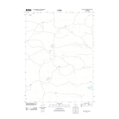
2011 Map of Bean Soup Lake
USGS Topo · Published 2011About this map
Winslow Valley and the surrounding ranchlands of Arthur County characterize this western Nebraska landscape in the early twenty-first century. The area is defined by a sparse network of family-operated holdings, including the Triangle Ranch and Kramer Ranch, connected by isolated routes such as Triangle Rd and Ellingrod Dr. This map documents a region where the high plains geography dictates a lifestyle centered on water and cattle, with natural features like Mechoalan Lake and Three Mile Lake serving as critical landmarks. Other significant agricultural properties, including the A Walz Ranch, B Ellingrod Ranch, and Threemile Ranch, further illustrate the enduring ranching economy of the Sandhills region.
Find a feature on this map
14 named features on this map. Tap any name to fly to it.
Don’t see what you’re looking for? This feature index may not catch every label — zoom into the map to look around manually.
Map Details
Editions of this 2011 Bean Soup Lake Map
This is the sole edition of this map. No revisions or reprints were ever made.
Other maps of this area

1948 · Carr Lake
USGS Topo · 1:62,500

1948 · Spring Valley
USGS Topo · 1:62,500

1949 · Arthur
USGS Topo · 1:62,500

1949 · Flats
USGS Topo · 1:62,500

1950 · Flats
USGS Topo · 1:62,500

1950 · Spring Valley
USGS Topo · 1:62,500

1950 · Carr Lake
USGS Topo · 1:62,500

1950 · Arthur
USGS Topo · 1:62,500

1954 · North Platte
USGS Topo · 1:250,000

1956 · North Platte
USGS Topo · 1:250,000