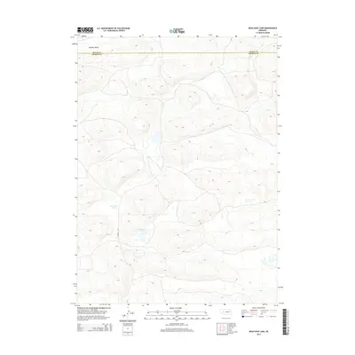
2014 Map of Bean Soup Lake
USGS Topo · Published 2014About this map
Bean Soup Lake and Mechoglan Lake define the hydrology of this Sandhills terrain along the border of Grant and Arthur counties. The landscape is characterized by a high concentration of enclosed basins and complex contouring, with Winslow Valley providing a named topographical depression in the northwestern corner. Human infrastructure is notably sparse in this 2014 survey, represented primarily by Triangle Rd, which navigates the undulating terrain between the dunes and depressions. The map illustrates the specialized ecological and geographic character of this Nebraska region, where surface water is concentrated in small, distinct lakes scattered across the valley floors.
Find a feature on this map
5 named features on this map. Tap any name to fly to it.
Don’t see what you’re looking for? This feature index may not catch every label — zoom into the map to look around manually.
Map Details
Editions of this 2014 Bean Soup Lake Map
This is the sole edition of this map. No revisions or reprints were ever made.
Other maps of this area

1948 · Carr Lake
USGS Topo · 1:62,500

1948 · Spring Valley
USGS Topo · 1:62,500

1949 · Arthur
USGS Topo · 1:62,500

1949 · Flats
USGS Topo · 1:62,500

1950 · Flats
USGS Topo · 1:62,500

1950 · Spring Valley
USGS Topo · 1:62,500

1950 · Carr Lake
USGS Topo · 1:62,500

1950 · Arthur
USGS Topo · 1:62,500

1954 · North Platte
USGS Topo · 1:250,000

1956 · North Platte
USGS Topo · 1:250,000