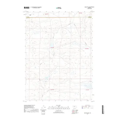
2017 Map of Bean Soup Lake
USGS Topo · Published 2017About this map
Bean Soup Lake and Mechoglan Lake anchor this 2017 study of the Nebraska Sandhills, located along the border of Grant and Arthur Counties. The landscape is defined by the unique topography of Winslow Valley and numerous ephemeral wetlands scattered throughout the dunes. This area remains largely open rangeland, characterized by a sparse network of ranch roads and tracks such as Kramer Rd, Triangle Rd, and Dykes Camp Rd. The map reveals the intricate drainage patterns and interior basins typical of this region, where water bodies like Threemile Lake sit at the low points of the rolling hills. Traces of human activity are minimal, represented primarily by named routes like Ellingrod Dr and N Lute Dr, which provide access across the vast stretches of public and private grazing land.
Find a feature on this map
17 named features on this map. Tap any name to fly to it.
Don’t see what you’re looking for? This feature index may not catch every label — zoom into the map to look around manually.
Map Details
Editions of this 2017 Bean Soup Lake Map
This is the sole edition of this map. No revisions or reprints were ever made.
Other maps of this area

1948 · Carr Lake
USGS Topo · 1:62,500

1948 · Spring Valley
USGS Topo · 1:62,500

1949 · Arthur
USGS Topo · 1:62,500

1949 · Flats
USGS Topo · 1:62,500

1950 · Flats
USGS Topo · 1:62,500

1950 · Spring Valley
USGS Topo · 1:62,500

1950 · Carr Lake
USGS Topo · 1:62,500

1950 · Arthur
USGS Topo · 1:62,500

1954 · North Platte
USGS Topo · 1:250,000

1956 · North Platte
USGS Topo · 1:250,000