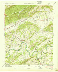
1939 Map of Bean Station
USGS Topo · Published 1939About this map
Clinch Mountain and Poor Valley dominate the northern landscape of this 1930s survey, illustrating the complex ridge-and-valley topography of East Tennessee. The Holston River winds through the southern reaches, its banks dotted with islands like Payne Island and Sycamore Island before the later impoundments changed the valley floor. Settlement is concentrated along the historic corridors of the Lee Highway and Dixie Highway, where the junction at Bean Station and the resort character of Tate Springs serve as primary hubs. Local life is recorded through a dense network of country churches and schools, including Merry Chapel, Crosby Sch, and Macedonia Sch, alongside industrial infrastructure like the Baging Station Morristown Municipal Power House near the Holston Bridge.
Find a feature on this map
67 named features on this map. Tap any name to fly to it.
Don’t see what you’re looking for? This feature index may not catch every label — zoom into the map to look around manually.
Map Details
Editions of this 1939 Bean Station Map
2 editions found
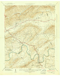
Other maps of this area

1883 · Morristown
USGS Topo · 1:125,000

1893 · Morristown
USGS Topo · 1:125,000

1895 · Morristown
USGS Topo · 1:125,000

1935 · Rogersville
USGS Topo · 1:48,000

1935 · Tate Springs
USGS Topo · 1:48,000

1935 · Lee Valley
USGS Topo · 1:24,000

1935 · Springvale
USGS Topo · 1:24,000

1935 · Howard Quarter
USGS Topo · 1:24,000

1935 · Swan Island
USGS Topo · 1:24,000

1935 · Avondale
USGS Topo · 1:24,000