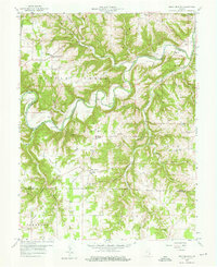
1959 Map of Bear Branch
USGS Topo · Published 1976About this map
Laughery Creek carves a winding path through the borderlands of Ohio and Dearborn counties, defining a landscape of deep hollows and high ridges in the mid-1950s. The settlement of Farmers Retreat stands as a focal point in Caesar Creek township, accompanied by St Johns Ch and its namesake school. Further south, the community of Bear Branch serves as a crossroads near the Ohio and Switzerland County line, where Freedom Sch and Olive Branch Ch once supported the rural population. Numerous family and church cemeteries, such as Conway Cem, Pelser Cem, and Pate Cem, are scattered across the uplands, offering significant data for genealogists. The map also reveals the rural layout of Downey Corner and Milton, connected by unimproved roads that trace the contours of Mexico Ridge and Sangamaw Ridge.
Find a feature on this map
51 named features on this map. Tap any name to fly to it.
Don’t see what you’re looking for? This feature index may not catch every label — zoom into the map to look around manually.
Map Details
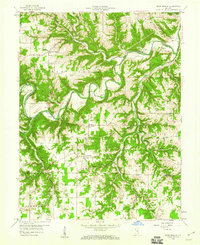
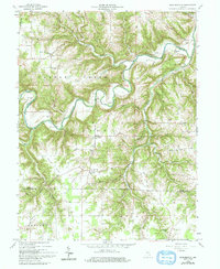
Editions of this 1959 Bear Branch Map
Other maps of this area

1915 · Lawrenceburg
USGS Topo · 1:48,000

1928 · Lawrenceburg
USGS Topo · 1:62,500

1932 · Lawrenceburg
USGS Topo · 1:62,500

1943 · Florence
USGS Topo · 1:24,000

1943 · Aberdeen
USGS Topo · 1:24,000

1943 · Aurora
USGS Topo · 1:24,000

1943 · Vevay North
USGS Topo · 1:24,000

1946 · Milan
USGS Topo · 1:24,000

1951 · Florence
USGS Topo · 1:24,000

1953 · Aberdeen
USGS Topo · 1:24,000