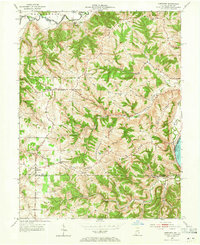
1953 Map of Aberdeen
USGS Topo · Published 1965About this map
The Ohio River forms the southeastern border of this 1953 survey, where the river meets the winding Grants Creek and Arnold Creek. The interior landscape is defined by a network of ridges, most notably Salem Ridge and Carmel Ridge, which influenced the placement of early settlements and road networks. Small crossroads communities like Aberdeen, Pate, and Hartford serve as anchors for the rural population, each clustered around local institutions.
Find a feature on this map
43 named features on this map. Tap any name to fly to it.
Don’t see what you’re looking for? This feature index may not catch every label — zoom into the map to look around manually.
Map Details
Editions of this 1953 Aberdeen Map
2 editions found

Other maps of this area

1915 · Lawrenceburg
USGS Topo · 1:48,000

1928 · Lawrenceburg
USGS Topo · 1:62,500

1932 · Lawrenceburg
USGS Topo · 1:62,500

1943 · Florence
USGS Topo · 1:24,000

1943 · Aberdeen
USGS Topo · 1:24,000

1943 · Aurora
USGS Topo · 1:24,000

1943 · Vevay North
USGS Topo · 1:24,000

1943 · Rising Sun
USGS Topo · 1:24,000

1943 · Lawrenceburg
USGS Topo · 1:24,000

1943 · Patriot
USGS Topo · 1:24,000