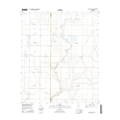
2015 Map of Bear Gut Bayou
USGS Topo · Published 2015About this map
The meandering Quiver River defines the landscape along the border of Sunflower and Leflore Counties in this detailed 2015 study. The territory is dominated by a complex network of Delta waterways, including the distinctively named Howling Wolf Bayou, Bear Gut Bayou, and Gin Bayou. These drainage patterns are interspersed with a grid of rural roads such as Itta Bena Rd and Romine-Morgan Rd, which connect remote family landmarks and agricultural holdings. Local history is anchored by the presence of Pleasant Valley Cem and Rock of Ages Cem, providing essential points of reference for genealogists. The land use is characterized by large-scale field divisions and specific topographical features like The Elbow, a sharp bend in the river that highlights the region's natural hydrology before it joins larger systems like the Roundaway Bayou.
Find a feature on this map
53 named features on this map. Tap any name to fly to it.
Don’t see what you’re looking for? This feature index may not catch every label — zoom into the map to look around manually.
Map Details
Editions of this 2015 Bear Gut Bayou Map
This is the sole edition of this map. No revisions or reprints were ever made.
Other maps of this area

1931 · Schlater
USGS Topo · 1:48,000

1934 · Cleveland
USGS Topo · 1:62,500

1934 · Schlater
USGS Topo · 1:62,500

1939 · Schlater
USGS Topo · 1:62,500

1940 · Baird
USGS Topo · 1:62,500

1940 · Cleveland
USGS Topo · 1:62,500

1953 · Greenwood
USGS Topo · 1:250,000

1956 · Greenwood
USGS Topo · 1:250,000

1961 · Mossy Lake
USGS Topo · 1:62,500
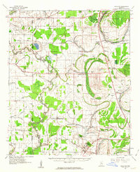
1961 · Schlater
USGS Topo · 1:62,500