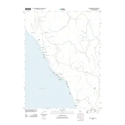
2012 Map of Bear Harbor
USGS Topo · Published 2012About this map
Sinkyone Wilderness SP dominates this coastal landscape where the steep mountains of the Lost Coast meet the Pacific Ocean. This survey details a transition from the rugged shoreline at Bear Harbor to the interior drainage of the Mattole River and its numerous tributaries like Indian Cr and Anderson Cr. The infrastructure consists of isolated outposts and specialized sites, including Bear Harbor Ranch, Wheeler, and Kenny, connected by the winding Usal Rd. The presence of Railroad Camp and various coastal landings such as Bear Landing reflects the area's legacy of maritime and timber logistics. Landmarks like Needle Rock, Jackson Pinnacle, and High Tip serve as critical navigational markers along this geologically active and steep coastline, while Jackass Ridge defines the eastern high ground.
Find a feature on this map
44 named features on this map. Tap any name to fly to it.
Don’t see what you’re looking for? This feature index may not catch every label — zoom into the map to look around manually.
Map Details
Editions of this 2012 Bear Harbor Map
This is the sole edition of this map. No revisions or reprints were ever made.
Other maps of this area

1920 · Pt. Delagda
USGS Topo · 1:62,500

1921 · Briceland
USGS Topo · 1:62,500

1949 · Eureka
USGS Topo · 1:250,000

1949 · Point Delgada
USGS Topo · 1:62,500

1949 · Garberville
USGS Topo · 1:62,500

1950 · Piercy
USGS Topo · 1:62,500

1951 · Garberville
USGS Topo · 1:62,500

1951 · Point Delgada
USGS Topo · 1:62,500

1957 · Ukiah
USGS Topo · 1:250,000

1958 · Redding
USGS Topo · 1:250,000