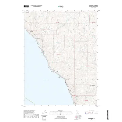
2018 Map of Bear Harbor
USGS Topo · Published 2018About this map
Kenny and Wheeler sit along the isolated Mendocino coastline, marking a landscape where the steep coastal mountains meet the Pacific Ocean. This terrain is defined by dramatic elevation changes, from the heights of Chamisal Mtn down to coastal landmarks like Needle Rock and Jackson Pinnacle. The map reveals a network of watercourses, including the Mattole River and Jackass Cr, which have carved deep canyons through the coastal range. Access to this remote region is limited to narrow routes like Usal Rd and the Timber Haul Rd, reflecting the area's history of logging and its preservation within Sinkyone Wilderness State Park. For those following the Lost Coast Trail, the map provides exact locations for offshore features such as Cluster Cone Rocks and Seal Rocks, which have long been navigational hazards and ecological landmarks along this undeveloped stretch of the California coast.
Find a feature on this map
43 named features on this map. Tap any name to fly to it.
Don’t see what you’re looking for? This feature index may not catch every label — zoom into the map to look around manually.
Map Details
Editions of this 2018 Bear Harbor Map
This is the sole edition of this map. No revisions or reprints were ever made.
Other maps of this area

1920 · Pt. Delagda
USGS Topo · 1:62,500

1921 · Briceland
USGS Topo · 1:62,500

1949 · Eureka
USGS Topo · 1:250,000

1949 · Point Delgada
USGS Topo · 1:62,500

1949 · Garberville
USGS Topo · 1:62,500

1950 · Piercy
USGS Topo · 1:62,500

1951 · Garberville
USGS Topo · 1:62,500

1951 · Point Delgada
USGS Topo · 1:62,500

1957 · Ukiah
USGS Topo · 1:250,000

1958 · Redding
USGS Topo · 1:250,000