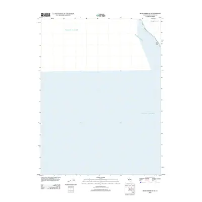
2012 Map of Bear Harbor OE W
USGS Topo · Published 2012About this map
The Pacific Ocean dominates this coastal survey, which documents a sparsely developed stretch of the Mendocino County shoreline. The map focuses on the interface between the open sea and the steep coastal rise of the King Range area, where Chamisal Mountain stands as a prominent topographical feature. The lack of inland roads or settlements highlights the wilderness character of this region, where the primary named landmarks are limited to maritime features like Small White Rock and the shoreline itself. This 2012 edition illustrates the rugged, undeveloped nature of the California coast in this northern reach, prioritizing coastal relief and natural hydrography over human infrastructure.
Find a feature on this map
3 named features on this map. Tap any name to fly to it.
Don’t see what you’re looking for? This feature index may not catch every label — zoom into the map to look around manually.
Map Details
Editions of this 2012 Bear Harbor OE W Map
This is the sole edition of this map. No revisions or reprints were ever made.
Other maps of this area

1920 · Pt. Delagda
USGS Topo · 1:62,500

1921 · Briceland
USGS Topo · 1:62,500

1949 · Eureka
USGS Topo · 1:250,000

1949 · Point Delgada
USGS Topo · 1:62,500

1949 · Garberville
USGS Topo · 1:62,500

1950 · Piercy
USGS Topo · 1:62,500

1951 · Garberville
USGS Topo · 1:62,500

1951 · Point Delgada
USGS Topo · 1:62,500

1957 · Ukiah
USGS Topo · 1:250,000

1958 · Redding
USGS Topo · 1:250,000