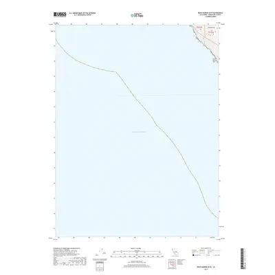
2018 Map of Bear Harbor OE W
USGS Topo · Published 2018About this map
The Pacific Ocean dominates this coastal survey, where the deep waters of the Mendocino coast meet the precipitous edge of the Northern California landmass. In the extreme northeastern corner, the terrain rises sharply from the shoreline toward the summit of Chamisal Mtn. This steep elevation change is characteristic of the region's dramatic geomorphology, where the coast mountains plunge directly into the sea with almost no transitional coastal plain. Offshore, Small White Rock serves as a lone navigational landmark along an otherwise unbroken marine horizon. The map captures the meeting point of the t5s r1e and t5s r2e survey townships, marking a remote boundary line where the wilderness of the King Range area transitions into the vast expanse of the Pacific.
Find a feature on this map
5 named features on this map. Tap any name to fly to it.
Don’t see what you’re looking for? This feature index may not catch every label — zoom into the map to look around manually.
Map Details
Editions of this 2018 Bear Harbor OE W Map
This is the sole edition of this map. No revisions or reprints were ever made.
Other maps of this area

1920 · Pt. Delagda
USGS Topo · 1:62,500

1921 · Briceland
USGS Topo · 1:62,500

1949 · Eureka
USGS Topo · 1:250,000

1949 · Point Delgada
USGS Topo · 1:62,500

1949 · Garberville
USGS Topo · 1:62,500

1950 · Piercy
USGS Topo · 1:62,500

1951 · Garberville
USGS Topo · 1:62,500

1951 · Point Delgada
USGS Topo · 1:62,500

1957 · Ukiah
USGS Topo · 1:250,000

1958 · Redding
USGS Topo · 1:250,000