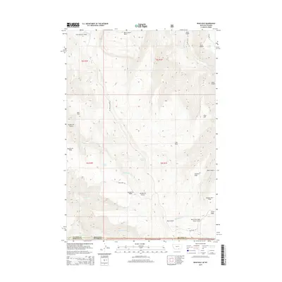
2014 Map of Bear Hole
USGS Topo · Published 2014About this map
Bighorn National Forest defines this high-elevation landscape along the border of Montana and Wyoming. The map documents a complex network of ridges and drainages within the Bighorn range, characterized by major watercourses such as Big Bull Elk Cr and Black Canyon Cr. Strategically placed water sources like Indian Springs, Commissary Spring, and Eagle Spring provided critical resources for early land management and ranching operations. The terrain is marked by distinctive named landmarks including Bear Hole, Point Lookout, and the aptly named Little Land. Access into these higher reaches is preserved through historical routes like Buffalo Pasture Rd and Garvin Basin Rd, which navigate the steep elevations between Big Bull Elk Ridge and Telephone Ridge.
Find a feature on this map
33 named features on this map. Tap any name to fly to it.
Don’t see what you’re looking for? This feature index may not catch every label — zoom into the map to look around manually.
Map Details
Editions of this 2014 Bear Hole Map
This is the sole edition of this map. No revisions or reprints were ever made.
Other maps of this area

1894 · St. Xavier
USGS Topo · 1:125,000

1898 · Bald Mountain
USGS Topo · 1:125,000

1901 · St. Xavier
USGS Topo · 1:125,000

1901 · Bald Mountain
USGS Topo · 1:125,000

1954 · Billings
USGS Topo · 1:250,000

1954 · Hardin
USGS Topo · 1:250,000

1955 · Cody
USGS Topo · 1:250,000

1955 · Sheridan
USGS Topo · 1:250,000

1957 · Hardin
USGS Topo · 1:250,000

1957 · Billings
USGS Topo · 1:250,000