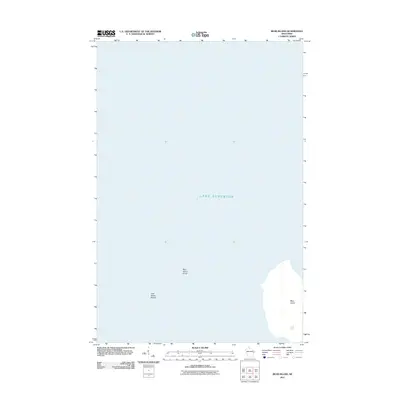
2011 Map of Bear Island
USGS Topo · Published 2011About this map
Lake Superior dominates this nautical landscape within the Apostle Islands, where the land mass of Bear Island emerges from the cold northern waters. The map focuses heavily on the submerged geography surrounding the island, detailing significant underwater hazards and navigation points. These features include the shallow reaches of Bear Island Shoal to the west of the island's primary landform and the York Island Shoals nearby. This 2011 edition provides a clear picture of the coastal shelf and water depths that define the perimeter of this remote island, serving as a critical reference for understanding the maritime environment of the archipelago before modern shifts in lake levels or shoreline erosion.
Find a feature on this map
4 named features on this map. Tap any name to fly to it.
Don’t see what you’re looking for? This feature index may not catch every label — zoom into the map to look around manually.
Map Details
Editions of this 2011 Bear Island Map
This is the sole edition of this map. No revisions or reprints were ever made.
Other maps of this area

1941 · Bayfield
USGS Topo · 1:48,000

1946 · Bayfield
USGS Topo · 1:48,000

1953 · Ashland
USGS Topo · 1:250,000

1954 · Two Harbors
USGS Topo · 1:250,000

1957 · Two Harbors
USGS Topo · 1:250,000

1958 · Ashland
USGS Topo · 1:250,000

1958 · Two Harbors
USGS Topo · 1:250,000

1963 · Rocky Island
USGS Topo · 1:62,500

1963 · Oak Island
USGS Topo · 1:24,000
1963 · Bear Island
USGS Topo · 1:24,000