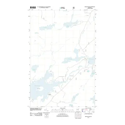
2011 Map of Bear Island
USGS Topo · Published 2011About this map
Bear Island Lake and the eponymous Bear Island dominate this northern Minnesota landscape, where the waters of the Bear Island River are regulated by the Bear Island Dam. This 2011 survey captures a region defined by its complex hydrology, featuring the small settlement of Rothman situated near the river's path. The map shows a network of forest roads and state routes, such as Hwy 21 N and Forest Rte 191, which provide access to numerous water bodies including Birch Lake, Johnson Lake, and the remote Muckwa Lake. The drainage patterns are clearly delineated by Longstorff Creek and Johnson Creek, illustrating the interconnected nature of the lakes and streams in the Superior National Forest area. Local landmarks such as Canary Lake and One Pine Lake appear alongside private roads like Runn Rd, suggesting a mix of public wilderness and isolated residential or recreational outposts.
Find a feature on this map
26 named features on this map. Tap any name to fly to it.
Don’t see what you’re looking for? This feature index may not catch every label — zoom into the map to look around manually.
Map Details
Editions of this 2011 Bear Island Map
This is the sole edition of this map. No revisions or reprints were ever made.
Other maps of this area

1933 · Ely
USGS Topo · 1:62,500

1939 · Ely
USGS Topo · 1:62,500

1949 · Isaac Lake
USGS Topo · 1:24,000

1950 · Isaac Lake
USGS Topo · 1:24,000

1951 · Babbitt
USGS Topo · 1:24,000

1952 · Babbitt NE
USGS Topo · 1:24,000

1954 · Two Harbors
USGS Topo · 1:250,000

1954 · Hibbing
USGS Topo · 1:250,000

1956 · Crab Lake
USGS Topo · 1:24,000

1956 · Eagles Nest
USGS Topo · 1:24,000
Featured Places
- Rothman, MN
- Birch Lake (Unorganized Territory), MN
- Morse Township, MN
- Saint Louis County, MN
- United States