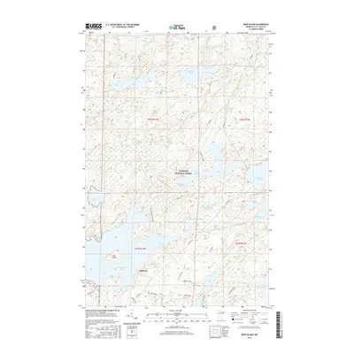
2016 Map of Bear Island
USGS Topo · Published 2016About this map
Bear Island dominates the central waters of this portion of Superior National Forest, situated within a complex network of glacial lakes and northern Minnesota timberland. The settlement of Rothman sits near the southern shore of Bear Island Lake, providing a focal point for local history amidst the surrounding wilderness. The hydrology of the region is defined by the flow of the Beaver River and the expansive reach of Birch Lake at the southern edge of the map.
Find a feature on this map
44 named features on this map. Tap any name to fly to it.
Don’t see what you’re looking for? This feature index may not catch every label — zoom into the map to look around manually.
Map Details
Editions of this 2016 Bear Island Map
This is the sole edition of this map. No revisions or reprints were ever made.
Other maps of this area

1933 · Ely
USGS Topo · 1:62,500

1939 · Ely
USGS Topo · 1:62,500

1949 · Isaac Lake
USGS Topo · 1:24,000

1950 · Isaac Lake
USGS Topo · 1:24,000

1951 · Babbitt
USGS Topo · 1:24,000

1952 · Babbitt NE
USGS Topo · 1:24,000

1954 · Two Harbors
USGS Topo · 1:250,000

1954 · Hibbing
USGS Topo · 1:250,000

1956 · Crab Lake
USGS Topo · 1:24,000

1956 · Eagles Nest
USGS Topo · 1:24,000
Featured Places
- Rothman, MN
- Birch Lake (Unorganized Territory), MN
- Morse Township, MN
- Saint Louis County, MN
- United States