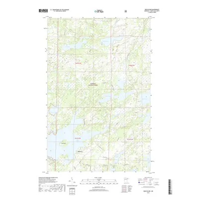
2019 Map of Bear Island
USGS Topo · Published 2019About this map
Superior National Forest defines the character of this northern Minnesota landscape, where a dense network of water bodies and seasonal roads supports a timber and recreation economy. The settlement of Rothman serves as a small anchor point near the southern edge of the map, situated just north of the expansive Birch Lake. Water dominates the geography, with the Bear Island River winding eastward from Bear Island Lake, connecting numerous lakes such as Mitchell Lake, One Pine Lake, and Canary Lake.
Find a feature on this map
41 named features on this map. Tap any name to fly to it.
Don’t see what you’re looking for? This feature index may not catch every label — zoom into the map to look around manually.
Map Details
Editions of this 2019 Bear Island Map
This is the sole edition of this map. No revisions or reprints were ever made.
Other maps of this area

1933 · Ely
USGS Topo · 1:62,500

1939 · Ely
USGS Topo · 1:62,500

1949 · Isaac Lake
USGS Topo · 1:24,000

1950 · Isaac Lake
USGS Topo · 1:24,000

1951 · Babbitt
USGS Topo · 1:24,000

1952 · Babbitt NE
USGS Topo · 1:24,000

1954 · Two Harbors
USGS Topo · 1:250,000

1954 · Hibbing
USGS Topo · 1:250,000

1956 · Crab Lake
USGS Topo · 1:24,000

1956 · Eagles Nest
USGS Topo · 1:24,000
Featured Places
- Rothman, MN
- Birch Lake (Unorganized Territory), MN
- Morse Township, MN
- Saint Louis County, MN
- United States