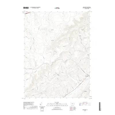
2019 Map of Bear Knob
USGS Topo · Published 2019About this map
Unionville sits at the foot of Bald Eagle Mountain, serving as a focal point for this section of Centre County where the Allegheny Front meets the valley floor. The landscape is defined by its deep hollows and prominent peaks, such as Bear Knob and Ganderstep Knob, which overlook a network of seasonal runs and historic travel ways. Significant for local historians, the area is dotted with small rural burial grounds, including the Dick's Run Advent Church Cem and the Bush Hollow Cem, reflecting the early settlement patterns of these narrow valleys. High-elevation paths like the Allegheny Front Trail (North) and the Ridge Trail trace the high ground, while the Rattlesnake Pike cuts across the terrain, linking the upland plateaus to the Bald Eagle Creek drainage system. This survey preserves the 2019 arrangement of family-named landmarks and the evolving trail networks that have long supported the local timber and agricultural economy.
Find a feature on this map
62 named features on this map. Tap any name to fly to it.
Don’t see what you’re looking for? This feature index may not catch every label — zoom into the map to look around manually.
Map Details
Editions of this 2019 Bear Knob Map
This is the sole edition of this map. No revisions or reprints were ever made.
Other maps of this area

1908 · Bellefonte
USGS Topo · 1:62,500

1909 · Bellefonte
USGS Topo · 1:62,500

1922 · Philipsburg
USGS Topo · 1:62,500

1928 · Snow Shoe
USGS Topo · 1:48,000

1929 · Karthaus
USGS Topo · 1:62,500

1931 · Show Shoe
USGS Topo · 1:62,500

1932 · Karthaus
USGS Topo · 1:62,500

1939 · Philipsburg
USGS Topo · 1:62,500

1943 · Lewistown
USGS Topo · 1:125,000

1945 · Philipsburg
USGS Topo · 1:62,500