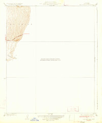
1933 Map of Bear Mountain
USGS Topo · Published 1933About this map
El Tejon dominates the western portion of this 1930s topographical study, where the abrupt rise of the mountains meets the valley floor. The map captures a transitional landscape defined by steep contour intervals and deep drainage systems like Sycamore Canyon. This particular sheet is a detailed sub-section focusing on the high-relief terrain of Bear Mountain, providing a closer look at the topography than the older, smaller-scale regional surveys mentioned in the center-field notation. A single primary artery, Bear Mountain Boulevard, winds through the elevation, serving as a critical link between the San Joaquin Valley and the heights of the Tehachapi range. The annotations for distances to Bakersfield, Arvin, and Tehachapi emphasize the area's role as a mountain pass corridor during the early decades of California's highway development.
Find a feature on this map
7 named features on this map. Tap any name to fly to it.
Don’t see what you’re looking for? This feature index may not catch every label — zoom into the map to look around manually.
Map Details
Editions of this 1933 Bear Mountain Map
3 editions found
Other maps of this area

1914 · Caliente
USGS Topo · 1:125,000

1929 · Bena
USGS Topo · 1:31,680

1930 · Bear Mountain
USGS Topo · 1:31,680

1930 · Arvin
USGS Topo · 1:31,680

1931 · Edison
USGS Topo · 1:31,680

1931 · Tejon Hills
USGS Topo · 1:31,680

1932 · Bena
USGS Topo · 1:31,680

1933 · Arvin
USGS Topo · 1:31,680

1933 · Tejon Hills
USGS Topo · 1:31,680

1933 · Bear Mountain
USGS Topo · 1:31,680