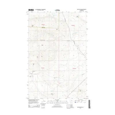
2014 Map of Bear Mountain
USGS Topo · Published 2014About this map
The settlement of Zortman sits at the southwestern base of the Little Rocky Mountains, marking a transition from the elevated peaks to the lower surrounding drainages. This landscape is defined by its numerous isolated buttes, including Coming Day Butte, Travois Butte, and Spring Park Butte, which rise distinctly above the drainage basins of Big Warm Cr and Beaver Cr. In the north, the Judith River Ridge defines the horizon, while the southern reaches are shaped by the winding paths of Beauchamp Cr and the presence of Ricker Butte. A network of rural roads like Beaver Creek Rd and Bear Gulch Rd connects the scattered landmarks and small settlements, such as the Youth Rnch, providing a detailed look at the infrastructure serving this portion of north-central Montana. The presence of Zortman Airport near the town center suggests a hub for local transit and firefighting or agricultural operations.
Find a feature on this map
35 named features on this map. Tap any name to fly to it.
Don’t see what you’re looking for? This feature index may not catch every label — zoom into the map to look around manually.
Map Details
Editions of this 2014 Bear Mountain Map
This is the sole edition of this map. No revisions or reprints were ever made.
Other maps of this area

1943 · Landusky
USGS Topo · 1:125,000

1953 · Havre
USGS Topo · 1:250,000

1954 · Lewistown
USGS Topo · 1:250,000

1957 · Havre
USGS Topo · 1:250,000

1958 · Havre
USGS Topo · 1:250,000

1959 · Lewistown
USGS Topo · 1:250,000

1971 · Bear Mountain
USGS Topo · 1:24,000

1971 · Robinson School
USGS Topo · 1:24,000

1971 · Hays SE
USGS Topo · 1:24,000

1971 · Bison Bone Reservoir
USGS Topo · 1:24,000