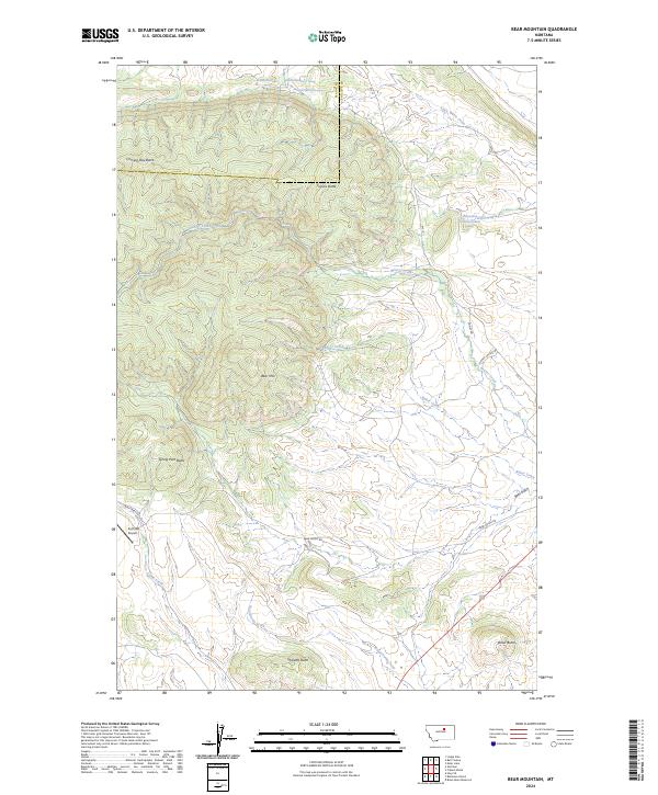
2024 Map of Bear Mountain
USGS Topo · Published 2024About this map
Coming Day Butte and Travois Butte dominate the northern horizons of this modern topographic survey, which covers a transition between the Blaine and Phillips county line in Montana. The landscape is defined by its distinct high points, from Bear Mtn in the center to the outlying Ricker Butte and Sharette Butte to the south. This is a region of high-plains drainage, where Beaver Creek and Baker Creek cut through the terrain, fed by specific upland springs such as 26N26E32ACAA01 Spring. Transportation in this area is limited to local routes like Rte 15 and Bear Gulch Rd, serving the aviation needs of the remote Zortman Airport in the southwest corner. The map provides a precise view of the hydrology and public land survey system divisions across townships t26n r25e and t25n r26e.
Find a feature on this map
27 named features on this map. Tap any name to fly to it.
Don’t see what you’re looking for? This feature index may not catch every label — zoom into the map to look around manually.
Map Details
Editions of this 2024 Bear Mountain Map
This is the sole edition of this map. No revisions or reprints were ever made.
Other maps of this area

1943 · Landusky
USGS Topo · 1:125,000

1953 · Havre
USGS Topo · 1:250,000

1954 · Lewistown
USGS Topo · 1:250,000

1957 · Havre
USGS Topo · 1:250,000

1958 · Havre
USGS Topo · 1:250,000

1959 · Lewistown
USGS Topo · 1:250,000

1971 · Bear Mountain
USGS Topo · 1:24,000

1971 · Robinson School
USGS Topo · 1:24,000

1971 · Hays SE
USGS Topo · 1:24,000

1971 · Bison Bone Reservoir
USGS Topo · 1:24,000