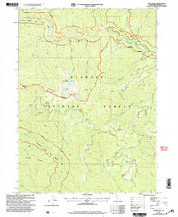
2001 Map of Bear Peak
USGS Topo · Published 2004About this map
Siskiyou Wilderness and the Klamath National Forest dominate this high-elevation landscape, where complex drainage systems define the rugged topography. The map illustrates a network of prominent ridgelines such as the Kelsey Range and the Dillon Divide, which separate the watersheds of Clear Creek and the North Fork Klamath River. Local geography is marked by isolated water features, including Bear Lake, Lower Bear Lake, and the curiously named Dry Lake. Historically significant boundary lines are evident, including the Standard Parallel North and an Indefinite Boundary near the river's path. Named springs like Elbow Spring and unique topographical markers like the Five and Ten Divide offer specific points of interest for researchers studying the historical backcountry of Siskiyou County.
Find a feature on this map
33 named features on this map. Tap any name to fly to it.
Don’t see what you’re looking for? This feature index may not catch every label — zoom into the map to look around manually.
Map Details
Editions of this 2001 Bear Peak Map
This is the sole edition of this map. No revisions or reprints were ever made.
Other maps of this area

1914 · Seiad
USGS Topo · 1:125,000

1922 · Preston Peak
USGS Topo · 1:125,000

1922 · Seiad
USGS Topo · 1:125,000

1948 · Weed
USGS Topo · 1:250,000

1950 · Weed
USGS Topo · 1:250,000

1955 · Dillon Mtn
USGS Topo · 1:62,500

1955 · Ukonom Lake
USGS Topo · 1:62,500

1956 · Happy Camp
USGS Topo · 1:62,500

1956 · Preston Peak
USGS Topo · 1:62,500

1958 · Weed
USGS Topo · 1:250,000