
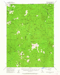
1956 Map of Preston Peak
USGS Topo · Published 1958About this map
Preston Peak stands at the center of this 1950s survey, a high-altitude landscape where the borders of Siskiyou National Forest, Six Rivers National Forest, and Klamath National Forest converge. The terrain is defined by the headwaters of the Middle Fork Smith River and South Fork Smith River, alongside the East Fork Illinois River to the north. While largely devoid of permanent towns, the area is dotted with remote outposts and seasonal sites including Porters Camp, Chicago Camp, and Bell Echo Camp.
Find a feature on this map
94 named features on this map. Tap any name to fly to it.
Don’t see what you’re looking for? This feature index may not catch every label — zoom into the map to look around manually.
Map Details
Editions of this 1956 Preston Peak Map
2 editions found
Other maps of this area

1908 · Grants Pass
USGS Topo · 1:125,000

1914 · Seiad
USGS Topo · 1:125,000

1917 · Kerby
USGS Topo · 1:125,000

1918 · Kerby
USGS Topo · 1:125,000

1922 · Preston Peak
USGS Topo · 1:125,000

1922 · Seiad
USGS Topo · 1:125,000

1945 · Ship Mountain
USGS Topo · 1:62,500

1945 · Kerby
USGS Topo · 1:125,000

1945 · Gasquet
USGS Topo · 1:62,500

1948 · Weed
USGS Topo · 1:250,000