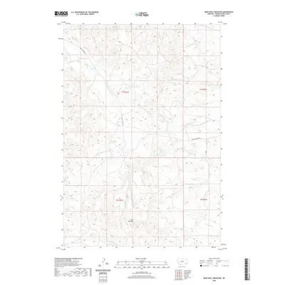
2020 Map of Bear Skull Mountain
USGS Topo · Published 2020About this map
Bear Skull Mtn serves as the central landmark for this section of Powder River County, where the high divide separates numerous drainage systems. The landscape is defined by the complex branching of Baking Powder Cr, including its N Fork Baking Powder Cr and S Fork Baking Powder Cr. These watercourses create a distinct dendritic pattern across the terrain, shaping the cattle country of southeastern Montana.
Find a feature on this map
19 named features on this map. Tap any name to fly to it.
Don’t see what you’re looking for? This feature index may not catch every label — zoom into the map to look around manually.
Map Details
Editions of this 2020 Bear Skull Mountain Map
This is the sole edition of this map. No revisions or reprints were ever made.
Other maps of this area

1954 · Ekalaka
USGS Topo · 1:250,000

1956 · Ekalaka
USGS Topo · 1:250,000

1958 · Ekalaka
USGS Topo · 1:250,000

1965 · Ekalaka
USGS Topo · 1:250,000

1970 · Pine Creek
USGS Topo · 1:24,000

1970 · Wild Bill Creek
USGS Topo · 1:24,000

1970 · Baldy Peak
USGS Topo · 1:24,000
1970 · Biddle
USGS Topo · 1:24,000
1970 · Bay Horse
USGS Topo · 1:24,000

1970 · Bear Skull Mountain
USGS Topo · 1:24,000