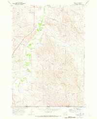
1970 Map of Biddle
USGS Topo · Published 1973About this map
The settlement of Biddle serves as a remote hub in the early 1970s, situated along the upper reaches of the Little Powder River. The landscape is defined by a dense network of intermittent drainages including Hay Creek, Bobcat Creek, and Bowers Creek, which carve through the high plains. The inclusion of a Landing Strip and several Drill Hole locations suggests the importance of aerial access and resource exploration in this corner of the Powder River Basin.
Find a feature on this map
17 named features on this map. Tap any name to fly to it.
Don’t see what you’re looking for? This feature index may not catch every label — zoom into the map to look around manually.
Map Details
Editions of this 1970 Biddle Map
This is the sole edition of this map. No revisions or reprints were ever made.
Other maps of this area

1954 · Ekalaka
USGS Topo · 1:250,000

1954 · Gillette
USGS Topo · 1:250,000

1955 · Gillette
USGS Topo · 1:250,000

1956 · Ekalaka
USGS Topo · 1:250,000

1958 · Gillette
USGS Topo · 1:250,000

1958 · Ekalaka
USGS Topo · 1:250,000

1962 · Gillette
USGS Topo · 1:250,000

1965 · Ekalaka
USGS Topo · 1:250,000

1970 · Pine Creek
USGS Topo · 1:24,000

1970 · Sanburn Reservoir
USGS Topo · 1:24,000